Crook County GIS is the county’s set of public online maps and property search tools, listed on its Maps & Apps page. The Crook County Online Map finds a tax lot, its zone and its floodplain.
Property Search Online shows the county tax roll record. It is linked from the Assessor’s page. Neither one tells you if you can legally reach the lot, what septic is on file, or what was built and permitted.
This guide shows how to use both, then spends most of its time on what they leave out. It is general information, not legal or title advice. We looked at these screens in November 2026, and screens change. Our example is the Crook County Courthouse at 300 NE 3rd St in Prineville, which the county owns.
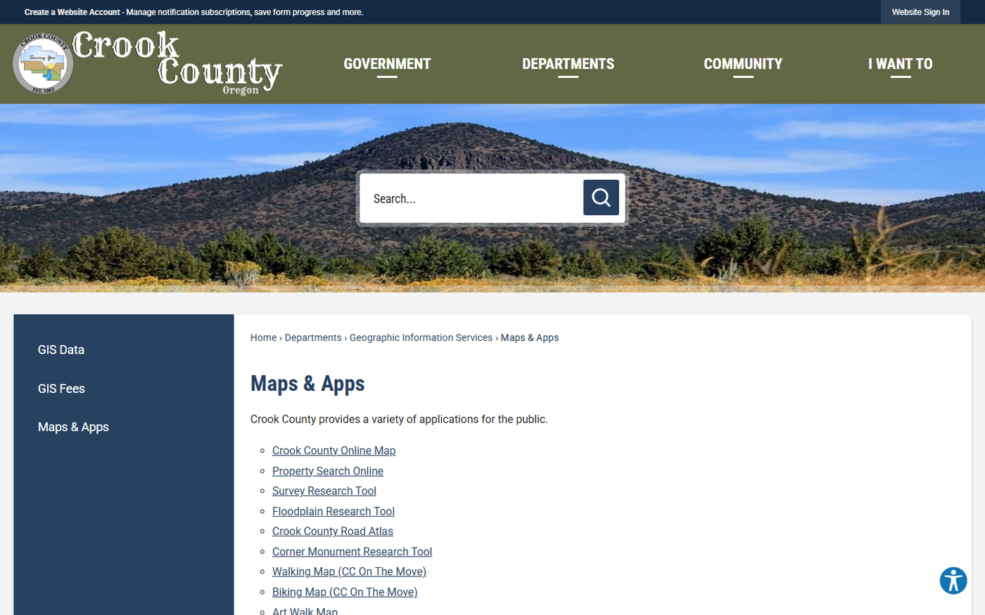
The same page also lists a Road Atlas and a Corner Monument Research Tool.
What does Crook County GIS not tell you?
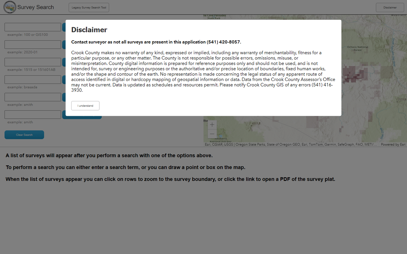
The county says so itself. Its survey tool opens with a disclaimer that county digital information is “prepared for reference purposes only.” Here is what that means in practice.
Legal access
A road on the map is not proof you can use it, and the county’s disclaimer says this: “No representation is made concerning the legal status of any apparent route of access identified in digital or hardcopy mapping of geospatial information or data.”
In our experience, legal access comes from a public road or a recorded easement, and the map shows neither as a right. Confirm access with the county and a title company before you rely on a road you can see.
Septic history
The county’s own GIS user guide says “Septic is not generally available on the websites.” It sends you to the onsite program by email, though that guide lists an older email domain. The Community Development page lists onsite@crookcountyor.gov.
On several Crook County lots we researched, the septic answer came from site evaluations on file with the county’s onsite program, not from GIS. Some lots had no septic records at all.
Surveys and boundaries
The survey tool’s disclaimer says: “Contact surveyor as not all surveys are present in this application (541) 420-8057.” The County Surveyor’s page links the tool.
The same disclaimer says county data is not intended for survey purposes or the “authoritative and/or precise location of boundaries.” Parcel lines on the map are not a survey. Our post on property pins covers the next step.
Easements and CC&Rs
In our experience, recorded easements and CC&Rs show up in the Clerk’s records, not on the map or in Property Search Online. The Clerk’s index is searchable by party name only. The Clerk section below covers how.
On one Crook County lot we researched, the map showed the zone. The county code sets that zone’s setbacks, not the map. Recorded CC&Rs required front and rear setbacks at least double those, and a wider side setback, and design approval before building.
CC&Rs differ by subdivision, so this is one lot. The pattern is the point: the map shows the zone, and recorded rules can be stricter than the county’s.
Permit history and what is actually built
The county’s Research Guide for the Public says “Permits were not required prior to 1973.” An old building may have no permit record at all.
An assessor label does not fill the gap. On one Crook County lot we researched, the assessor’s class read “Res Improved.” The permit records showed earlier building permits had been withdrawn. What stood on the lot was an open question that needed a site visit.
Earlier land use decisions
The Planning Applications app shows only applications processed “within the last year (365 days).” Older decisions are not in it, so ask the Planning Department.
An older decision can set where the house goes. On one farm-zoned Crook County lot we researched, a partition decision had approved a dwelling on a set homesite. It also set the septic location and conditions to meet before a building permit. The zone label alone showed none of that.
Power, water and irrigation
The map’s layer list, as we read it in November 2026, has no layer for soils, wetlands, slope, wildfire hazard, septic or wells. We did not see an irrigation layer either. The county’s GIS Data page says it does not distribute data it did not create or maintain, “e.g. Water rights, soils data, etc.”
Our reports pull soils from the Natural Resources Conservation Service and well logs from the Oregon Water Resources Department.
On several Crook County lots we researched, power was down the road but not at the lot. Ask the electric utility for a written service plan. Irrigation canal and pipeline easements showed up on recorded plats and easements, not on the map.
Flood map date
The county’s Floodplain layer gives no effective date or source citation in its layer description. The City of Prineville points people to FEMA’s Map Service Center. Check the current map there.
Whether you can build
None of the tools in this guide says if a house is allowed. The Online Map, the Floodplain Research Tool, the Planning Applications app and the Survey Search tool carry the “reference purposes only” disclaimer.
In our experience, a rural dwelling depends on the zone and often on a county review. The map’s zone label does not explain that.
In Crook County’s EFU-1, EFU-2 and EFU-3 farm zones, a house not tied to farming (a nonfarm dwelling) needs a county land use review with public notice. The Crook County farm zone code sets the tests. The house must not significantly change or add cost to farming on nearby land, and the site must be generally unsuitable for farming. Land that is mostly soil classes I to VI is presumed farmable. The lot must have been created before 1993 or through the county’s nonfarm division rules. Land under farm special assessment must be disqualified, with any added tax or penalty paid, before the building permit. Other tests apply too, including a study of dwellings in the surrounding area and density limits in deer and elk winter range.
New parcels generally must be at least 160 acres in EFU-1 and EFU-3 and 80 acres in EFU-2. Deer and elk winter range areas have their own minimums, and a farm unit with usable irrigation water rights or a nonfarm division can allow smaller parcels. A decision like the partition approval on the farm-zoned lot above can already answer some of these.
In Park Reserve (P-R) land, a house is a conditional use under the Crook County Park Reserve code, except in Juniper Hills, Jasper Knolls, Bottero Park and Indian Rock PUD, where it is allowed outright. The findings for a house include farm tests: compatible with farming, and on land generally unsuitable for farming.
The EFU rules follow Oregon’s farmland protection law, Statewide Planning Goal 3 and ORS chapter 215. The P-R findings borrow some of that farm wording, though P-R is not an EFU zone. Confirm with Crook County Planning.
How do you search the Crook County Online Map?
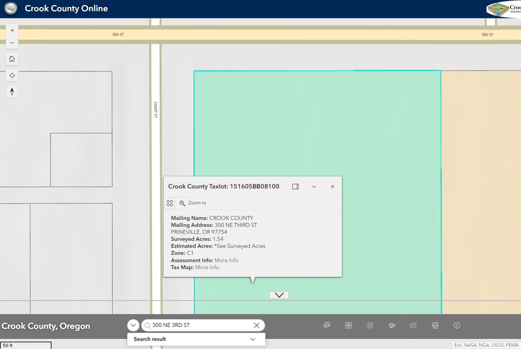
Open the Crook County Online Map from the Maps & Apps page. The Quick Search bar has three sources: Account, Taxlots and Addresses.
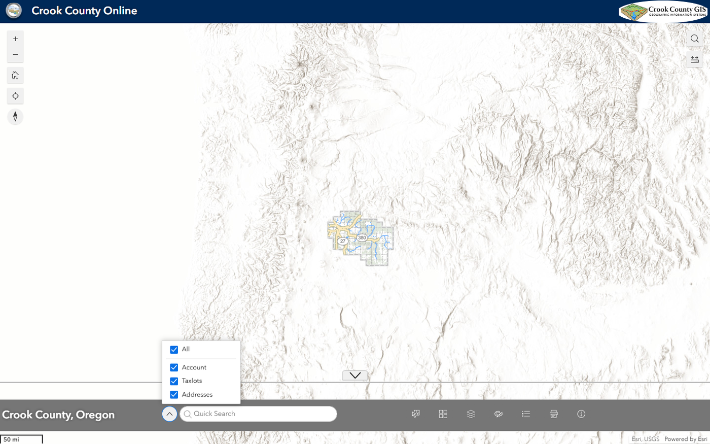
Type the address and pick the result. For our example we typed 300 NE 3RD ST. The result opened a pop-up with the parcel details and a “Zoom to” link.
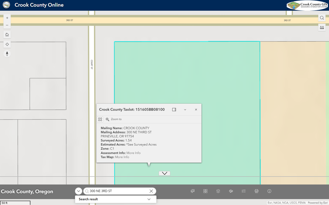
On the courthouse lot, the pop-up shows the mailing name and address, surveyed acres, zone, and links for Assessment Info and Tax Map. Treat the mailing name as a lead on the owner, not proof of ownership.
The taxlot number is worth learning. The County Surveyor’s page says every taxlot has a 13 character code broken into township, range, section, quarter quarter and taxlot number. Our example, 151605BB08100, reads as township 15, range 16, section 05, quarter quarter BB, taxlot 08100. Copy it exactly.
The county’s GIS guide says “Zoning is listed under Planning, flood zones are listed under Water.” In the map’s data source, most layers start switched off, so open the layer list and turn them on.
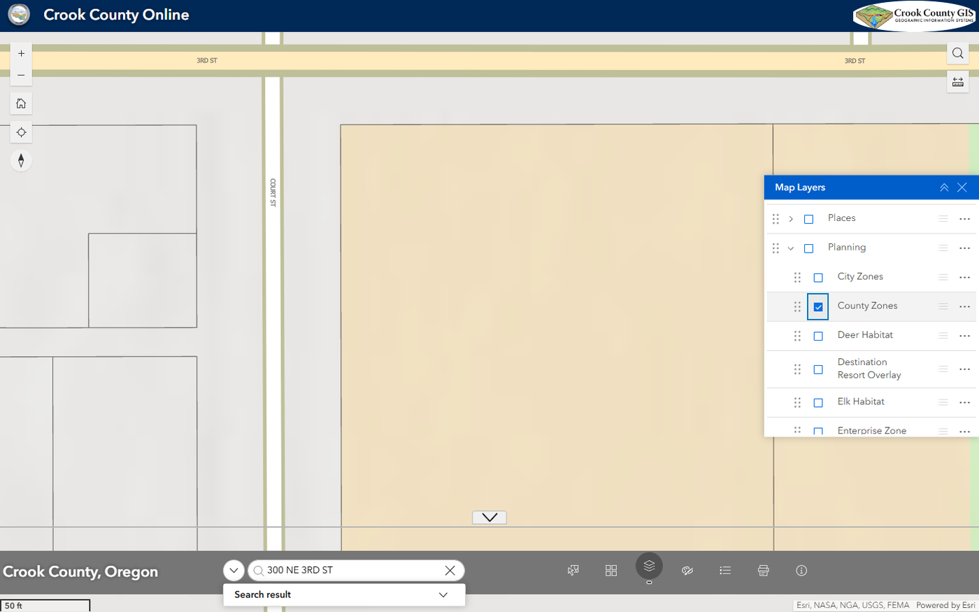
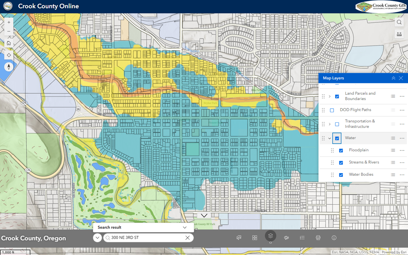
Save or print the map for each layer you check. A “no” is useful too, because it shows what you looked at.
How does Crook County Property Search Online work?
The Crook County Assessor’s page links to Property Search Online. Its search page opens with a disclaimer. The information comes from the county tax roll, and Property Search Online says “These are not the official records of the Tax Department.” It also says to enter as little as possible, such as “1234 5th” instead of a full address.
Pick how you want to search from the menu next to the box, which opens on Account ID. Our courthouse account opened a page with the situs address (the property’s physical address), mailing address, map and taxlot, owner name and assessment values by year.
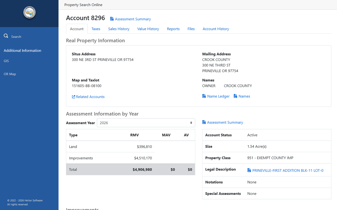
The page has tabs for Taxes, Sales History, Value History, Reports, Files and Account History. It also shows size, property class, notations and special assessments. Read the notations and special assessments on every lot.
The data has limits. Property Search Online’s own disclaimer says “The County does not guarantee the accuracy of information on this website.” Property class is the assessor’s label. It does not say what is built or whether it was permitted.
How do you check permit history for a Crook County property?
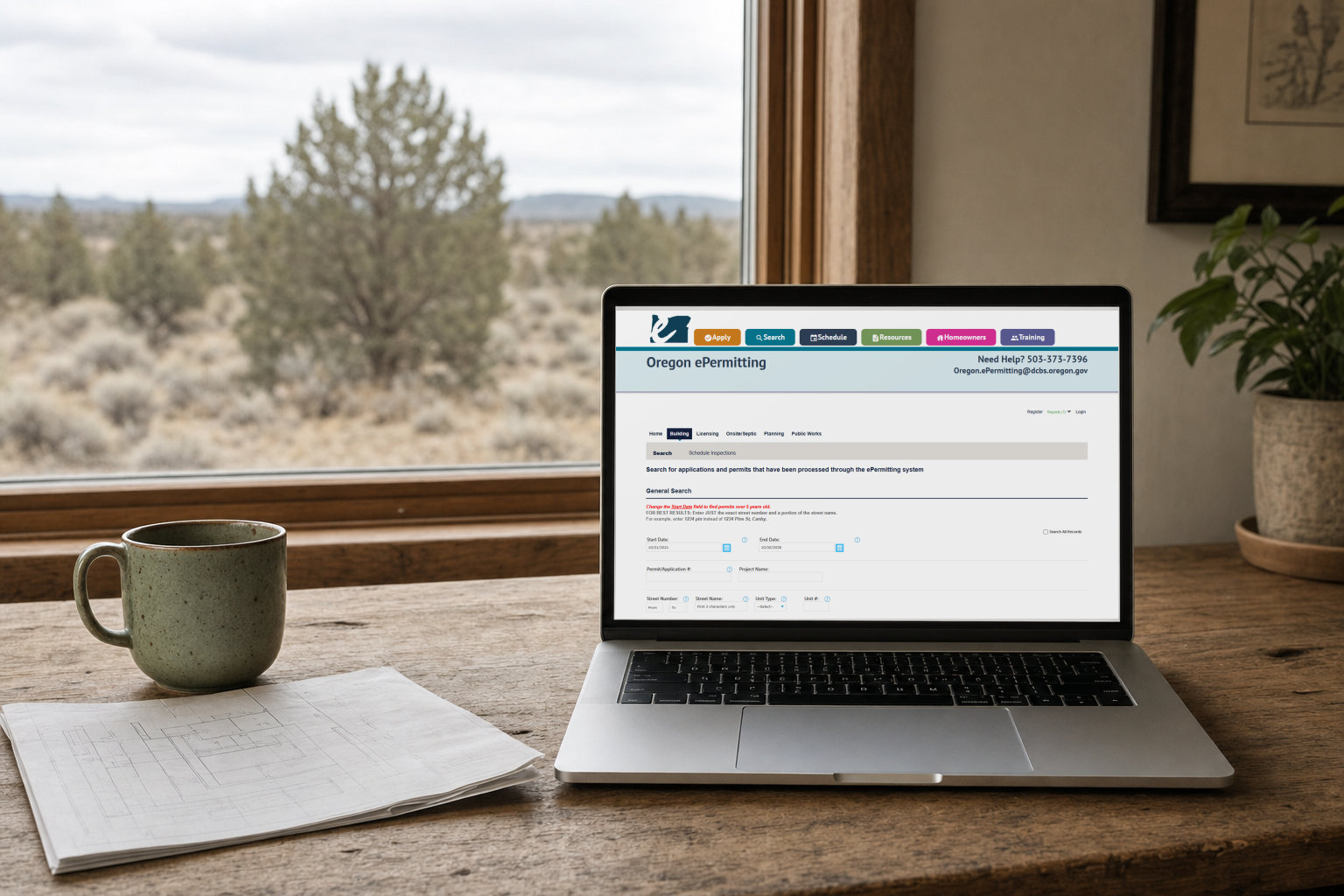
The Building Department page says permit history searches, applications, payments and inspection scheduling run through Oregon ePermitting, the state’s system. Our Oregon ePermitting guide walks through it.
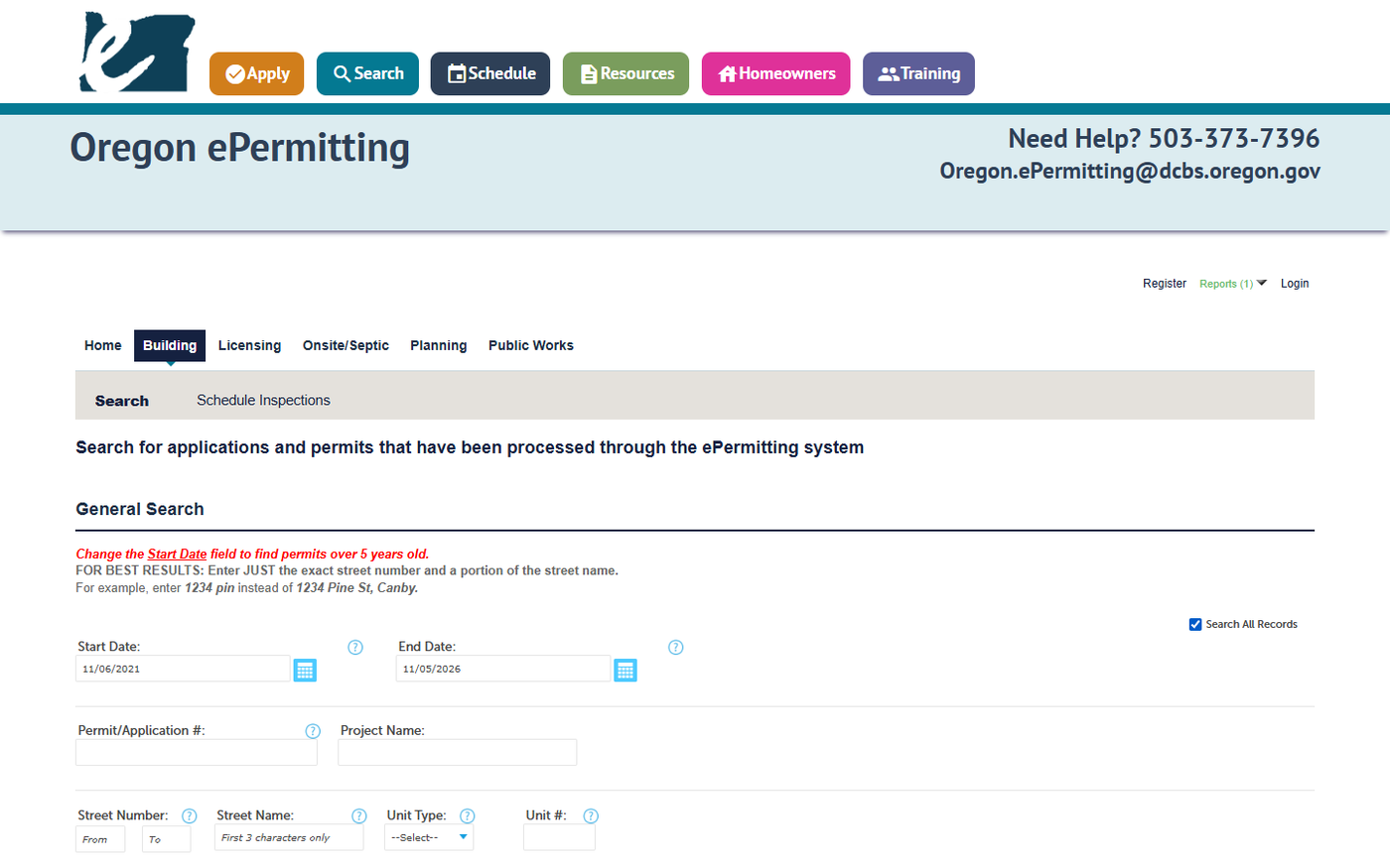
The search page tells you to change the Start Date to find permits over 5 years old. It also says to enter just the street number and part of the street name. The county’s research guide adds that the system “can be difficult to navigate” and lists a Documents Upload/View step for scanned documents.
The row of tabs above the search form includes Onsite/Septic. The county’s Research Guide lists Onsite/Septic permits as searchable there. The county’s GIS guide still says septic is not generally on the websites. Check the tab, and if nothing comes up, email the onsite program.
The county warns to trust only emails ending in @crookcountyor.gov or @accela.com.
How do you confirm what is recorded in the Clerk’s index?
The Clerk’s Digital Research Room page says: “All of our documents are indexed and searchable by the names of the parties on the document.” It also says: “Addresses, map numbers, account number or legal descriptions are not searchable.”
So start with the owner name from Property Search Online. Search that name for deeds and liens. In our experience, easements and CC&Rs turn up there too.
Open each document and check that it describes your lot, since one owner can have several properties. For CC&Rs on a subdivision lot, ask the seller or a title company for the recorded copy.
The county says deed records are indexed back to circa 1882, but some before 1971 may not appear in a search. Other records run from circa mid 1971. A lobby terminal in the Clerk’s office is free to use for research.
The Clerk also offers a Property Recording Alert Service. It sends free email alerts when documents are recorded under names you choose. The index is a search aid. A title report is how a sale confirms what is recorded.
Run the free checks from home
The SiteFacts Land Buyer's Field Guide has a one-page checklist and 15 free checks to run from home, plus a decoder for 12 listing phrases.
Is the property in Prineville or unincorporated Crook County?
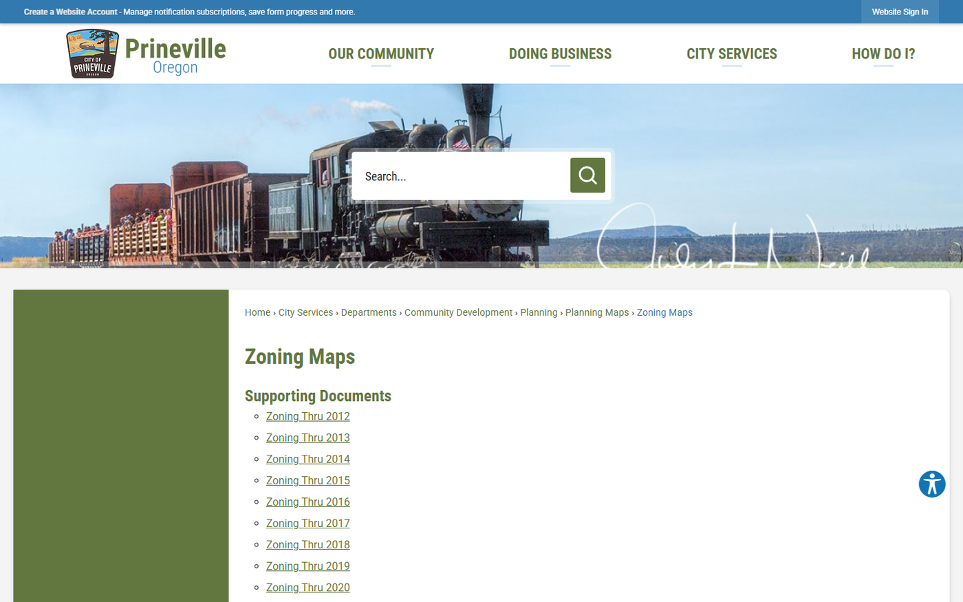
Check this first, because it decides whose rules apply, and the county map has separate County Zones and City Zones layers. The City of Prineville posts its own zoning maps as yearly PDFs.
County Code Compliance says its “jurisdiction covers all unincorporated areas of Crook County and some urban growth areas.” Our Prineville page covers the city.
Who do you call when the tools run out?
The Assessor’s office lists (541) 447-4133. The County Clerk lists (541) 447-6553.
County pages list more than one number for GIS and for Community Development. Use the department’s own page for the current one: Geographic Information Services and Community Development.
The county tools show the lot. They don't show if it can support a home.
Access, septic, easements and permit history sit outside the county map. A real person responds within 24 business hours.
If you are buying or building in Crook County, our Due Diligence page covers SiteFacts Reports, which look at zoning, access and other site questions the county map leaves open. Our permitting service covers filing the application once you are ready. Building permit package submittals: from $750. The city or county that issues the permit approves it.
See our Crook County page and Crook County permit guide for local detail. SiteFacts is a product of Sand & Sage Solutions LLC.
Quick checklist
- Right lot: address, taxlot number, account number and owner name
- City or county: County Zones or City Zones layer checked
- Zone, floodplain and other layers saved as maps
- Notations and special assessments read on Property Search Online
- Permit history searched in Oregon ePermitting, with an early start date
- Septic history requested from the county onsite program
- Owner names searched in the Clerk’s index for easements and CC&Rs
- Legal access confirmed in writing, not from a road on the map
- Survey checked, or the County Surveyor called
- Power service confirmed with the utility
- Anything uncertain flagged for a title report
Quick answers
Where do I find Crook County GIS?
The county’s Maps & Apps page lists the Online Map, Property Search Online, the Survey Research Tool, the Floodplain Research Tool and more.
Does Crook County GIS show septic records?
Not generally. The county’s GIS user guide says septic is not generally available on the websites. Ask the county onsite program.
Can I search the Clerk’s records by address?
No. The Clerk’s page says addresses, map numbers, account numbers and legal descriptions are not searchable. Search by the names of the parties.
Will there be permits for an older building?
Maybe not. The county’s research guide says permits were not required prior to 1973.
Can I build a house on farm land in Crook County?
Sometimes. In Crook County’s EFU farm zones, a house not tied to farming needs a county land use review with public notice, under the Crook County farm zone code. Other dwelling paths, such as a farm dwelling or a replacement dwelling, have their own tests. Confirm with the Planning Department.
What if I find an error on the county map?
The disclaimer asks you to notify Crook County GIS of errors. Use the number on the GIS department page, since county pages list more than one.
Where do I pay Crook County property taxes?
The Assessor’s page links a Pay Taxes Online site run by a third party. Property Search Online also has a Taxes tab for each account.
This guide is general information from Sand & Sage Solutions, not legal or title advice. For a question about who holds title or whether a lien is valid, ask a title company or an attorney licensed in Oregon.